Aerial surveying from drone imagery is disruptively efficient
Aerial surveys can be completed in less time and expense than traditional approaches with the use of Unmanned Aerial Vehicle (UAV) imagery. Resulting surveys are accurate and have broad uses for many industries and applications.
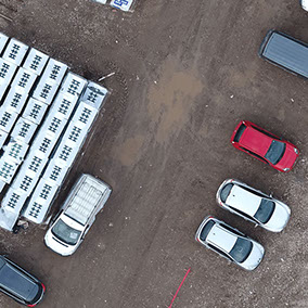
Drone Survey Models will take care of the drone data capture with an experienced licensed insured operator and process it into accurate 3D models and 2D maps widely compatible with GIS software and other professional platforms.
Volume Calculations
Area Calculations
Distance Calculations
Processed using professional industry standard software
Captured drone data will be processed with the latest professional industry software, this will usually be Pix4D. The latest proven software will give the most accurate reliable results for your survey.
2D & 3D Outputs
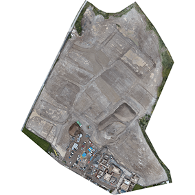
2D Orthomosaic Map GeoTIFF
The orthomosaic will give you a high resolution aerial map. It will be correctly georeferenced and scaled enabling precise measurements to be taken.
DSM & DTM GeoTIFF/LAS
The Digital Surface Model (DSM) provides accurate elevation data in a high resolution format. The Digital Terrain Model (DTM) has objects above the ground surface removed.
Topographic Contour SHP/DXF
The topographic map also provides elevation data across the surveyed area represented visually by contour lines.
3D Point Cloud LAZ
A high resolution 3D positioned array of full coloured points. Can be viewed as a 3D model and measurements taken from it or further processing can be done with the data.
Surveys precisely calibrated and positioned using GCPs
A number of Ground Control Points (GCPs) are spaced around the survey area and their positions taken with GNSS equipment. This helps to calibrate the data to be both absolutely and relatively accurately positioned.
You can expect a typical aerial survey to be accurate to within 24mm horizontally, 36mm vertically and hundreds of times higher resolution than a normal topographical survey. Even higher accuracies could also be achieved depending on your requirements and the size of the site to be surveyed.
Contact Us
For a quote or other enquiry please either:
call 01823 781881
email info@dronesurveymodels.co.uk
or use the contact form
Drone Survey Models is owned and operated by Cheslyn Edwards and based in Wellington, Somerset.
Drone / UAV survey services are offered throughout the South West.
Copyright © 2017 Cheslyn Edwards. Web design by Cheslyn Edwards


